Some amenity designers would do anything to mess with the #openstreetmap database

Some amenity designers would do anything to mess with the #openstreetmap database
Hemos salido a dar una vuelta aprovechando el buen día que se ha quedado hoy.
He visto a mucha gente hablar de #openstreetmap y me he instalado de fdroid la aplicación de Android @streetcomplete y en nada de tiempo he rellenado 31 tareas. Crea vicio la aplicación 

Ein Thema, dass mir leider auch immer wieder über den Weg läuft, ist Videoüberwachung. Ich hab mich sehr gefreut, dass Falk Zscheile (Vorstandsmitglied, OSM Deutschland / @FOSSGISeV) die „Surveillance under Surveillance“-Karte vorgestellt hat. Dort sieht man sämtliche eingetragenen Kameras  , die einen tagtäglich überwachen! Jeder kann übrigens welche hinzufügen! #clt2025 #openstreetmap #osm #uberwachung
Schaut mal rein: https://sunders.uber.space/

It's nearly impossible to delete objects in Google Maps. A THREAD.
Situation 1:
I found a point duplicating recycling centre. Both points have different names so I chose to delete the one with a typo in it's name and with no reviews. I marked that point for deletion 7 times, each time Google rejected my edit after only a minute. I guess they use dumb bots to review edits. There is no way a human can review that quickly.
I love stumbling on low hanging fruit for @streetcomplete points. LOL #OpenStreetMap
Mozilla (this time @MozillaAI) just keeps on giving: After polluting their own commons with “AI” garbage (ie Firefox with the useless “chatbot integration”), they now tried doing the same for #openstreetmap 
This already sucked when Facebook was doing it and it being “open source” doesn’t do anything to mitigate the actual harmful impact  (seems that the “commit to OSM” at least was turned off for now, thanks @grischard!)
https://blog.mozilla.ai/map-features-in-openstreetmap-with-computer-vision/
OK, this has been messing with my head for the past couple of hours, and I've only just figured out why~
Lille: Permanence Openstreetmap, Le mardi 25 mars 2025 de 18h00 à 20h00. https://www.agendadulibre.org/events/32080 #openstreetmap #osm #rencontre #permanence
THIS is the way! @organicmaps migration to @forgejo 
Hope migration succeeds and GitHub shitshow can be left behind.
The fact that #komoot has just been sacrificed to #enshittification makes #OrganicMaps even more important 
#osm #openstreetmap
RE: mastodon.social/users/organicmaps/statuses/114178913189564775

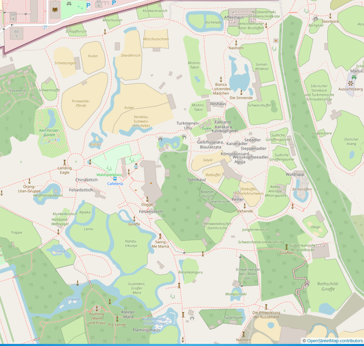
the level of detail in #OpenStreetMap is just wonderful #Tierpark #Berlin  It's a sunny day, perfect for a walk with @streetcomplete open later today
  #Mapstodon
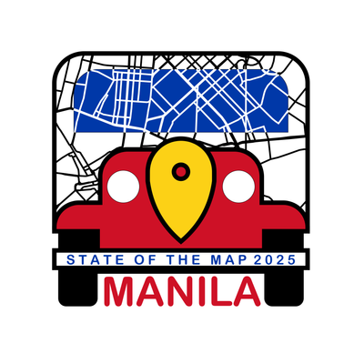
Do you want to present and talk at State of the Map, the annual global OpenStreetMap conference? It's happening this year in Manila & online, and you can apply today!
The Call for Participation is now open! Submit your talk today!
https://2025.stateofthemap.org/calls/general/
#OpenStreetMap #OSM #gischat #sotm #sptm2025 @sotm
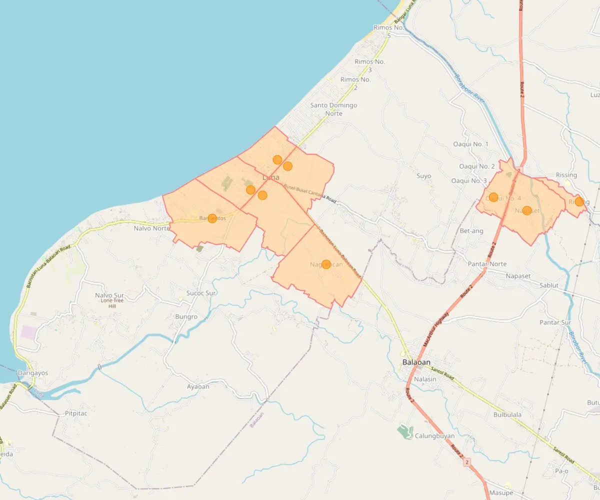
Next up in my #OpenStreetMap + #Wikidata barangay mapping/open data series¹ are the 40 barangays of the municipality of Luna in the northern province of La Union. I’m currently done with 9 barangays in OSM.
A big thanks to JR Dizon of the Luna Municipal Planning and Development Office for the boundary data.
¹ Previous: https://en.osm.town/@seav/114092122864097831
#Komoot just got acquired by #BendingSpoons (Meetup, WeTransfer, Evernote, etc.)
https://finance.yahoo.com/news/bending-spoons-acquires-komoot-171600458.html

Seeking recommendations for a #WebMapping tutorial / course?
Slightly at sea on where to start.
- My current JS skill level is _extreme novice_.
- I don't have access to ArcGIS.
- Comfortable with #QGIS [*] and the #python #geospatial ecosystem (#geopandas #xarray #rasterio and plotting with #matplotlib)
Suggestions welcome. TIA. 
* I have looked at the qgis2web plugin, but having some issues associated with my aged laptop (2012 mbp running Ubuntu) and a 'Wayland session'.
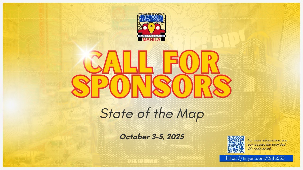
 #StateoftheMap Call for Sponsorships
Partner with us be part of the historic first global #SotM happening in Southeast Asia! Let's open more doors to advancing open data, community engagement, and mapping innovation and paving the way for further collaboration among the #OpenStreetMap and global mapping community.
To learn more about sponsorship packages, check: https://2025.stateofthemap.org/SOTM_2025_Sponsorship_Prospectus.pdf
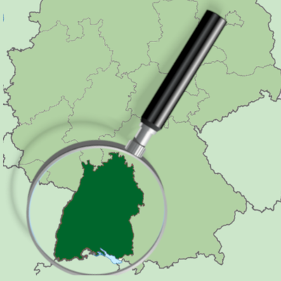
I've just came across @OSM_tourism, which is an account promoting tourism of South Germany on #OpenStreetMap. I presume adding features that tourists are interested in.
Not the kind of tourism that I do as an OSMer...
- Visiting the first registered address of OSMF (actually a virtual office) https://youtube.com/shorts/6kENvAPdUxc?si=nC5_icZOy64sAf2D
- Taking a photo of Geofabrik offices
- Spotting "OSM Surveyor Was Here" stickers
- Mapping extreme detail outside the home of legendary contributors
- ect.
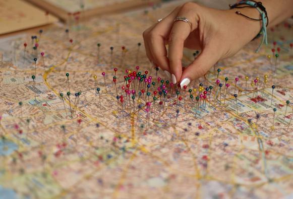
Je trouve ça quand même dingue qu'on puisse diffuser une carte complète du monde sur un serveur premier prix 
https://tileserver.lacasa.fr/styles/osm-bright/?vector#14.69/43.23563/1.57698
vous souhaitez pouvoir venir en famille avec de la garde d'enfants au prochain State of the Map ? dites le moi, avec l'équipe d'organisation on va essayer de faire ça.
Heute ist #OpenStreetMap kaum noch aus dem Alltag wegzudenken - und bleibt dabei oft unsichtbar https://www.heise.de/hintergrund/20-Jahre-OpenStreetMap-Auf-Augenhoehe-mit-Google-Maps-und-Apple-Maps-9829308.html?seite=all
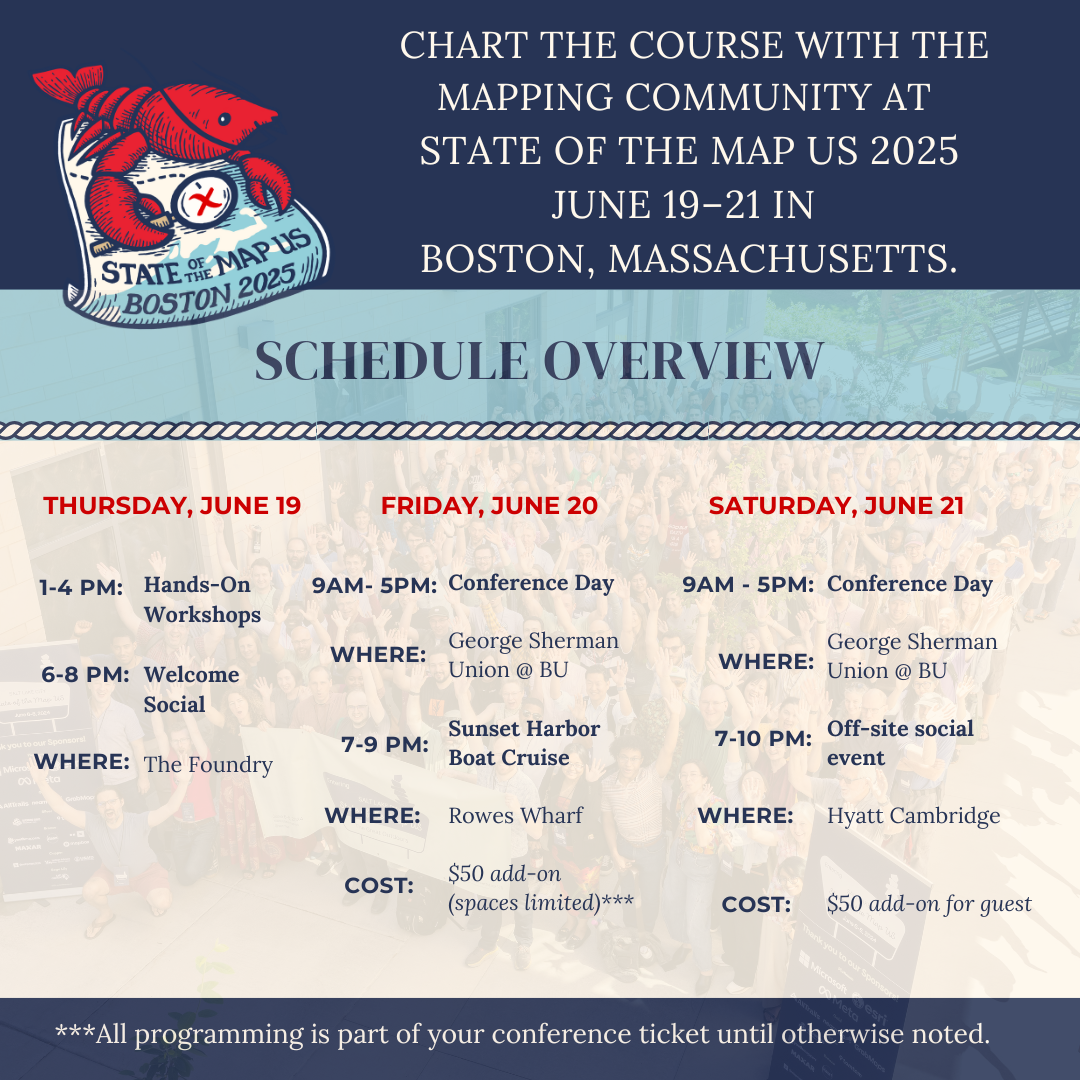
The #SOTMUS schedule is almost up! To give you an idea, #StateoftheMapUS gets underway on Thursday, June 19th in the afternoon at The Foundry in Cambridge. then we have two full days of conference programming on Friday and Saturday at Boston University. We wrap things up with a social at the Hyatt Cambridge
Snag your tickets and join us! https://bit.ly/sotmus2025tix